Telecom
Drone cell tower inspection software for improved accuracy and reduced costs
Standardize inspection procedures and reduce job closeout costs with our cell tower inspection software
Telecom
Drone cell tower inspection software
Standardize inspection procedures and reduce job closeout costs with our cell tower inspection software
Our drone cell tower inspection software reduces the time and cost of performing drone cell tower inspections and analytics by automating and streamlining the process for capturing and identifying issues impacting cellular performance.
Improve productivity and collaboration by standardizing the workflow for managing, processing and visualizing drone cell tower inspection results in a single platform
Download Whitepaper
“8 Ways to Optimize Drone Asset Inspections: Optelos Puts Together Lessons Learned from Enterprise Clients”

Tower inspection audits conducted under the TIA-222-H Standard (2017) involve detailed analysis of a tower’s structural design, and the fabrication of new or the modification of existing antenna supporting structures.
Optelos provides access to all data required to streamline cell tower pre-construction site assessment and audit tasks, from building and analyzing 3D Digital Twin models to customizable dashboards tied to your workflows.
Digital twin models can be used to compare construction drawings to as-builts 3D digital twin models. This method ensures all required corrective actions are documented and completed within the warranty period.
Lease assessment is vital for efficiently managing tower space and planning future expansions for maximizing revenue for tower owners and delivering optimal cell tower RAN performance at the lowest cost to carriers.
Understanding the weight and physical profile of antenna groups is vital in mount analysis. This information helps in assessing whether a particular RAD Center can support the antenna both physically and functionally.
Addressing Passive Intermodulation (PIM) effectively is crucial for network performance. Optelos stands out in this field by combining expert drone operations with a robust data analysis platform.
“Optelos has been critical in our PIM mitigation project by identifying issues from the desktop and allowing us to share large, detailed 3D models with our distributed turf vendors in real-time to come to agreement and make decisions immediately. We’ve cut our required onsite time by more than 50%.”
Manager, Tier 1 Telecom Provider
Cell Tower Drone Inspection Services
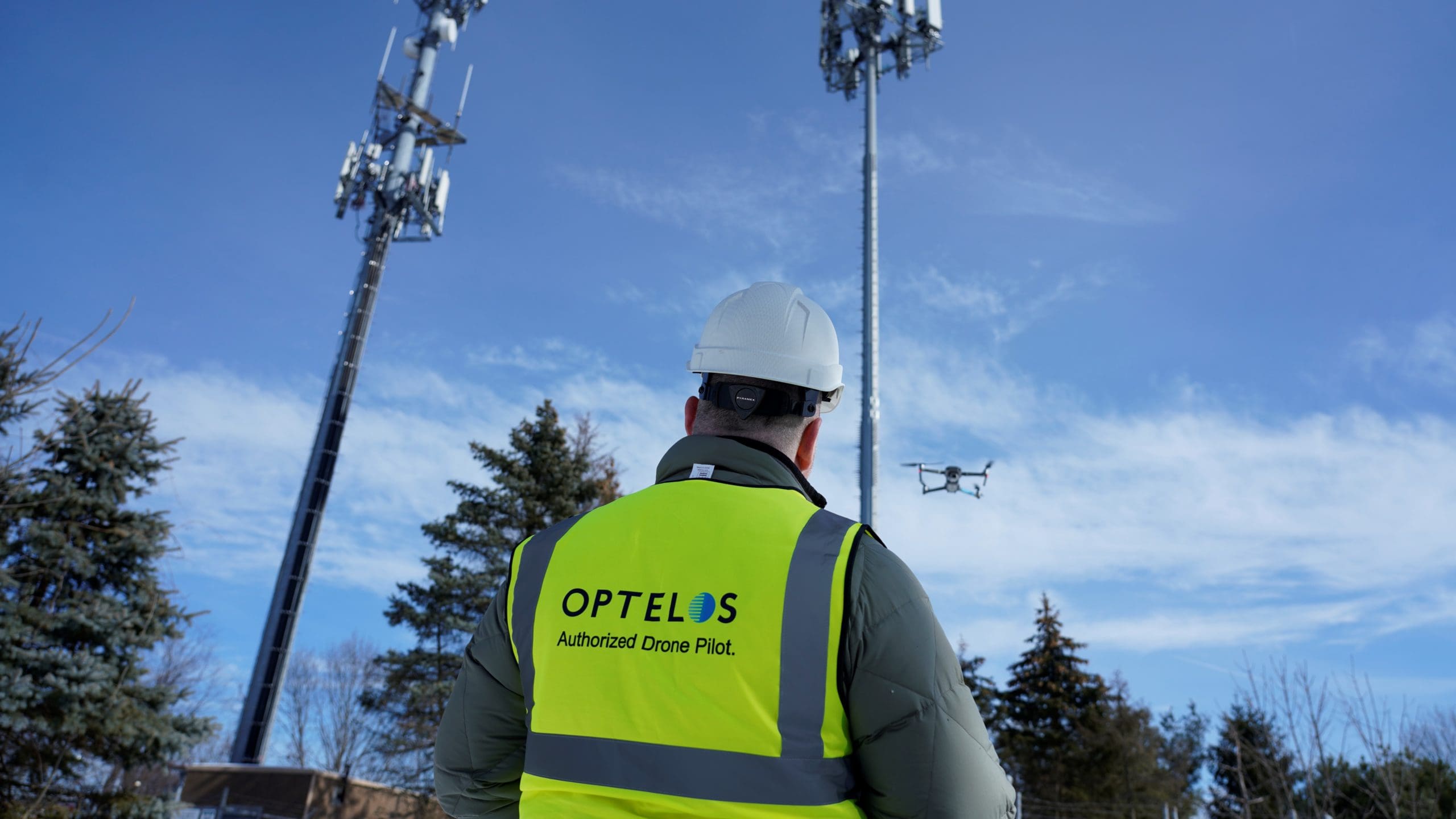
Optelos offers turnkey drone flight services utilizing data capture protocols optimized to produce the industry’s highest quality 3D Digital Twin and 2D Orthomosaic models to support your digital transformation program:
- Optelos provides complete turnkey drone cell tower inspection services across North America and select other countries.
- Training services for field force, drone pilots, and 3rd party vendors collecting data for the carrier to ensure consistent, accurate and reliable drone cell tower inspection results across all sites.
- Seamlessly import cell tower inspection data collected from drones directly into the Optelos platform to immediately analyze and take action on inspection results, saving time and reducing data management costs.
- Learn more about our turnkey professional services and how Optelos can help you digitally transform your asset inspection program using the link below.
Pre- / Post-Construction Audits
Utilize Digital Twins to assess cost to construct or verify the accuracy of modifications or contracted installations. View all relevant data in context, speeding cross-functional team analysis. Avoid return trips to the site by having a complete, high resolution 3D model for remote inspection:
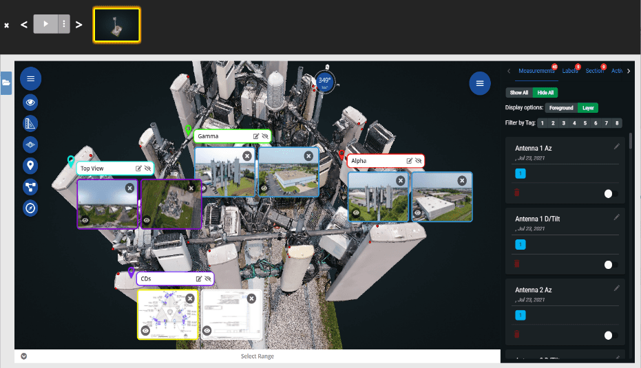
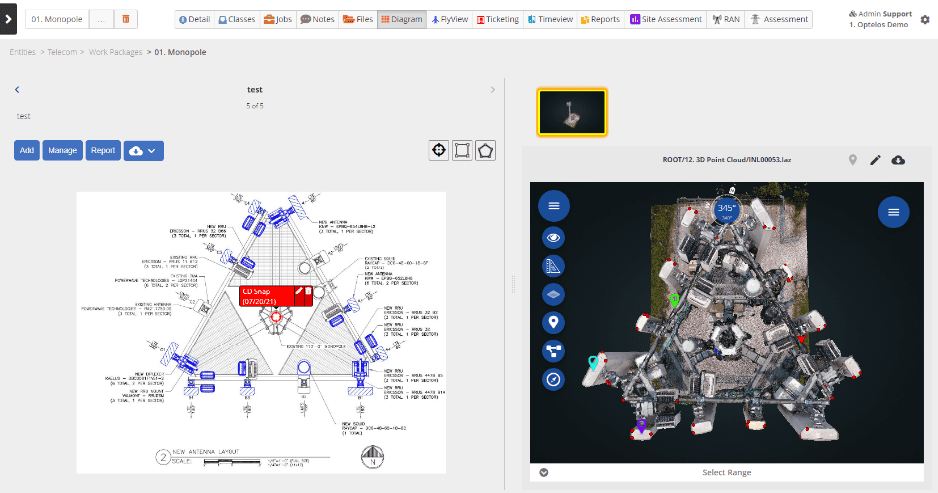
- View drone cell tower inspection data in visual context by geolocating and associating construction drawings, RFDS, and antenna spec sheets directly onto 3D Digital Twin models.
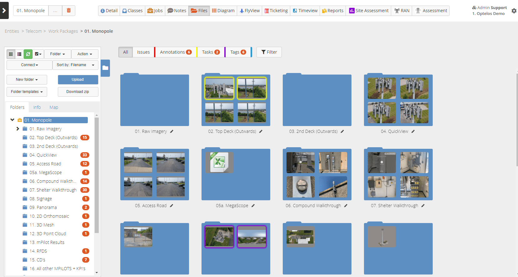
- Manage all your drone cell tower inspection data in one unified database location and eliminate disparate data silos.
Generate Detailed 3D Models for Sales & Lease Planning
- Build best-in-class 3D point cloud models accurate to 1mm and .1 degree with our digital twin inspection software.
- Use high resolution 3D models and photos to accurately document and share options for equipment placement, cabling availability and other conditions impacting cell tower lease capacity.
- Easily annotate and securely share 3D Digital Twin models with stakeholders, 3rd party vendors and end customers to drive leasing decisions and commitments.
Tower Inspection Audit Visualization
Access and view drone cell tower inspection audit and post construction audit data in context, speeding cross-functional team analysis, insights and fault resolution:
- Built-in data viewers for all document types, such as cell tower drone inspection images, videos, PDFs, panoramas, 2D ortho maps, 3D digital twin models, MS Office documents, and many more formats.
- Easily and securely share documents within the platform and control access through access levels.
- No need for multiple 3rd party software licenses to view files and make decisions.
Structural Analysis – Compare As-Built to Engineering Drawings
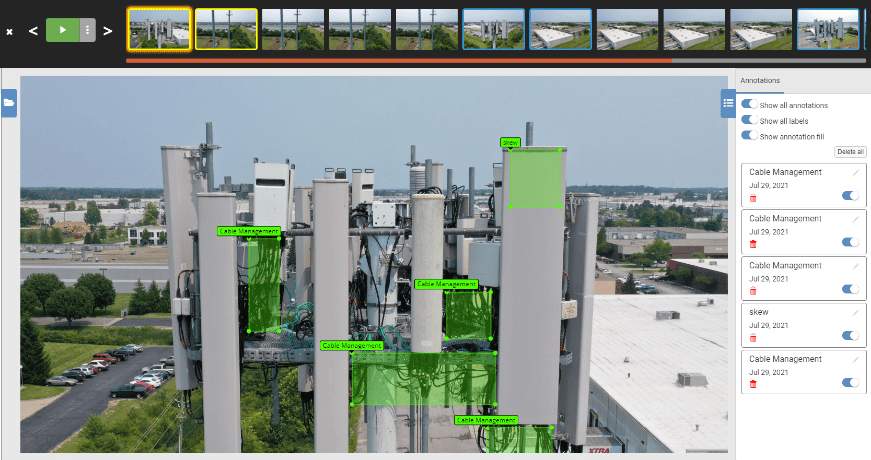
- Drone cell tower inspection software that compares CAD design documents to actual 3D models side-by-side to rapidly identify potential structural issues.
- Quickly detect and flag design issues, discrepancies, and build requirements before they are service impacting.
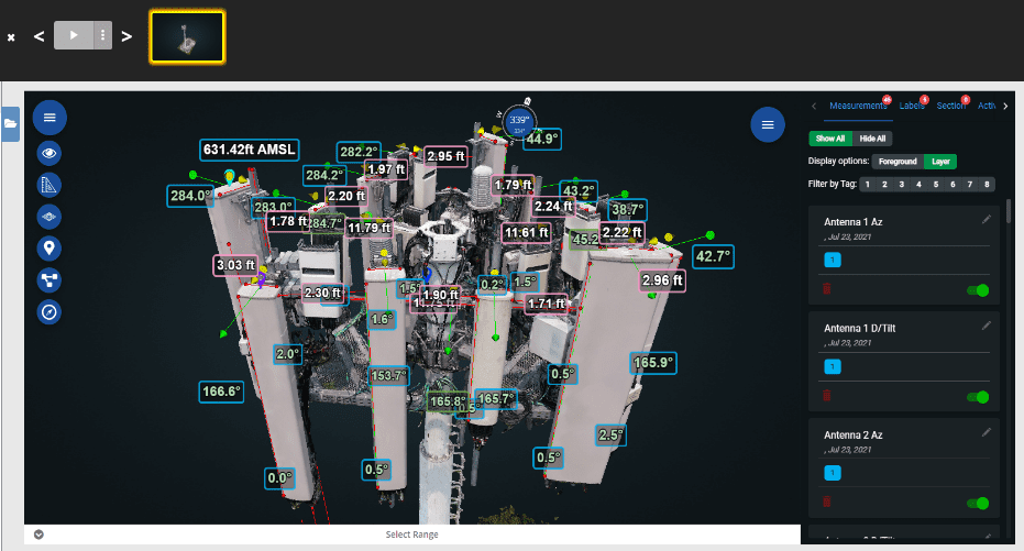
Equipment Analysis – Measure Antenna Azimuth and Downtilt to Optimize Tower Performance
- Utilize hi-res 3D point cloud models to make precise antenna measurements and complete detailed analysis without a site visit.
- You can use drone tower inspection data to complete “desktop engineering” for pre-project scoping and analysis.
- A full set of integrated measurement tools allow comprehensive analysis using either point cloud or mesh 3D digital twin models.
3D Model Sectioning Tool Improves Measurements and Analytics
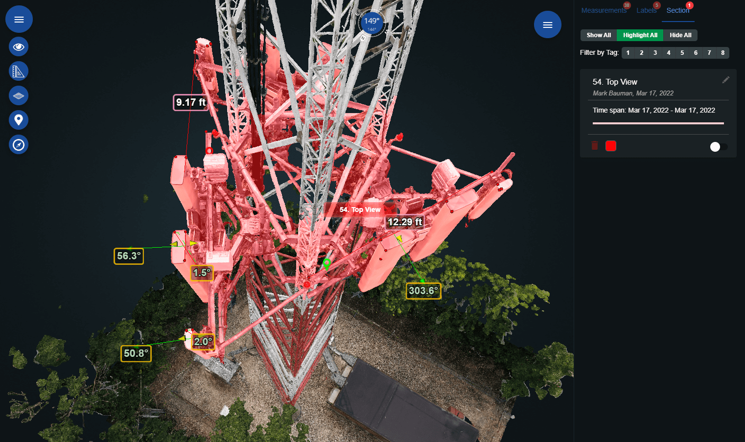
The sectioning tool allows you to isolate portions of the cell tower structure to perform detailed 360 degree cell tower inspection analysis:
- Remove obstructing equipment and structural elements to complete accurate measurements, determine azimuths and downtilt or complete equipment inspections of assets that would otherwise be obscured.
- Share an isolated deck slice to focus turf vendor attention on a specific cell tower section with all irrelevant or competitive infrastructure and assets removed from the larger 3D model.
Virtual Walkthroughs of Ground Level Site Inspections
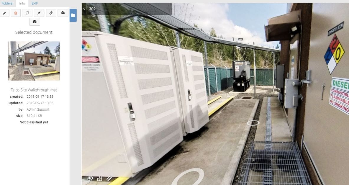
- Seamlessly integrate Matterport 3D walkthrough visualizations, so you can view detailed 360° panoramic inspection images without a site visit.
- See “inside the shelter” to inspect and verify available control shack rack space, connectivity and power availability.
- Evaluate physical obstructions, lease impairments and other important pre-project inspection details.
Streamline Site Assessment Workflow
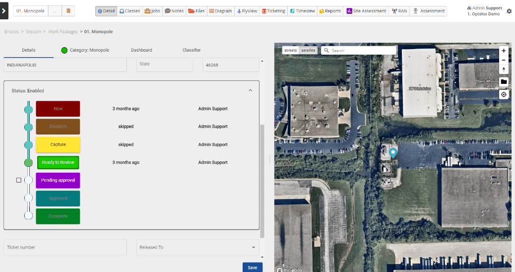
- Manage the entire end-to-end workflow of any drone cell tower inspection project including tower inspection audits, 5G scoping and PIM analysis.
- Jointly review project details necessary for tower planning, expansion, or addressing performance issues.
- Identify and document all repair components and required technician skills prior to starting your drone tower inspection project.
- Track status of all sites in dashboard roll-up reports using Telco Site Assessment feature.
Visibility and Tracking of All Tower Assets
- Telecom tower inspection software to manage your entire cell tower portfolio in one place via custom dashboards and tracking drone tower inspection progress and results.
- Create reports which track the status of observed cell tower defects by site.
- Monitor entities which have not completed their mandated drone cell tower inspection audits.
- Track inspection results by geography, including the count of outstanding work orders.
Improve Team Collaboration and Information Sharing
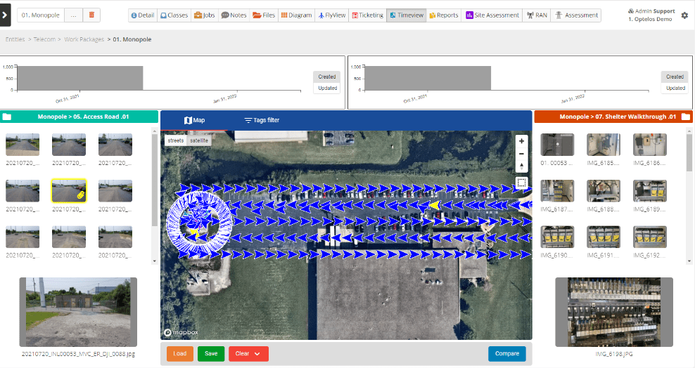
- View and share all drone cell tower inspection images in geographic context. View image location, lens angle and time stamp for a complete contextual view of available inspection imagery for effective project oversight.
- Documents such as antenna and radio data sheets, user manuals, inspection reports, work orders. As well as technical files such as CAD drawings, engineering plans, site surveys call all be securely shared and appended to 2D and 3D models, improving collaboration.
- Share sensor data and measurements from LiDAR inspection, thermal imagery, radio emissions, as well as collected images and 2D/3D models.
Active Member of NATE UAS Committee
