Platform Overview
Data in. Answers out. Get immediate insights for the Built world.
Our platform combines AI with digital twin technology to transform asset inspections and safety applications.
We combine AI detection, digital twins, and no-code automation to transform inspections — detecting failures, protecting people, and powering safer infrastructure
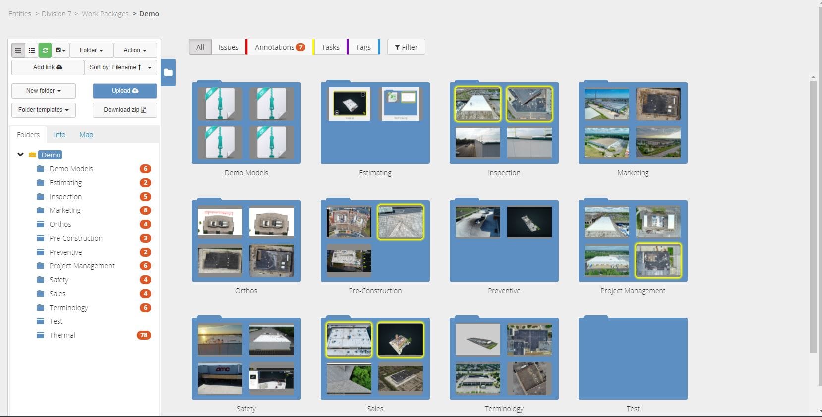
Optelos can ingest and transform any visual data source into an AI ready contextualized database allowing stakeholders to better understand asset conditions, prevent costly failures, protect workers, and extend the life of critical assets.

Single Pane of Glass
- Ingests and manages all data sources and types
- Creates a unified, structured database
- Visual and intuitive digital twin inspection software

Contextualized Data
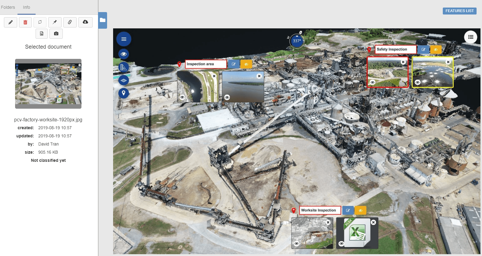
- Immersive 3D visualizations
- Digital Twin asset management
- Patented transformation algorithms

Automated AI Insights
- End-to-end AI inspection software
- Use any AI engine
- Annotate and label within platform

Enhanced Collaboration
- Securely share data
- Integrated file viewers and visualization tools
- Open architecture for systems integration
Optelos provides a complete visual data management system with digital twin asset management, AI powered inspection workflows, and team collaboration.
“That’s where Optelos crushes the competition –in their 3D models. Their meshes are really good. In addition, the Optelos interface does a really good job of showcasing their 3Ds to give a better perspective or view of a particular crack or problem area.”
Paul Aitken, Chief Pilot, Drone U
Ingest and contextualize any data
Our patented visual data management system (US Patent No. 10,418,068) geolocates and correlates data from any source, organizing vast amounts of unstructured visual data into an intuitive, contextualized and searchable database ready for analysis and AI implementation.
- Organize data by folder, each with its own user access level for data compliance.
- Share data with stakeholders inside and outside the organization.
Drone inspection services are available to assist in data capture.
Digital Twin data visualizations
Utilize the platform to create precise 2D orthomosaic maps and 3D Point cloud and 3D Mesh to deliver unmatched inspection clarity. View and share all types of data through the platform with a robust set of visualization tools and viewers:
- Open and view files without underlying program access, such as drone mapping software.
- View CAD, engineering drawings, 3D models, LiDAR, thermal and 360 panorama images.
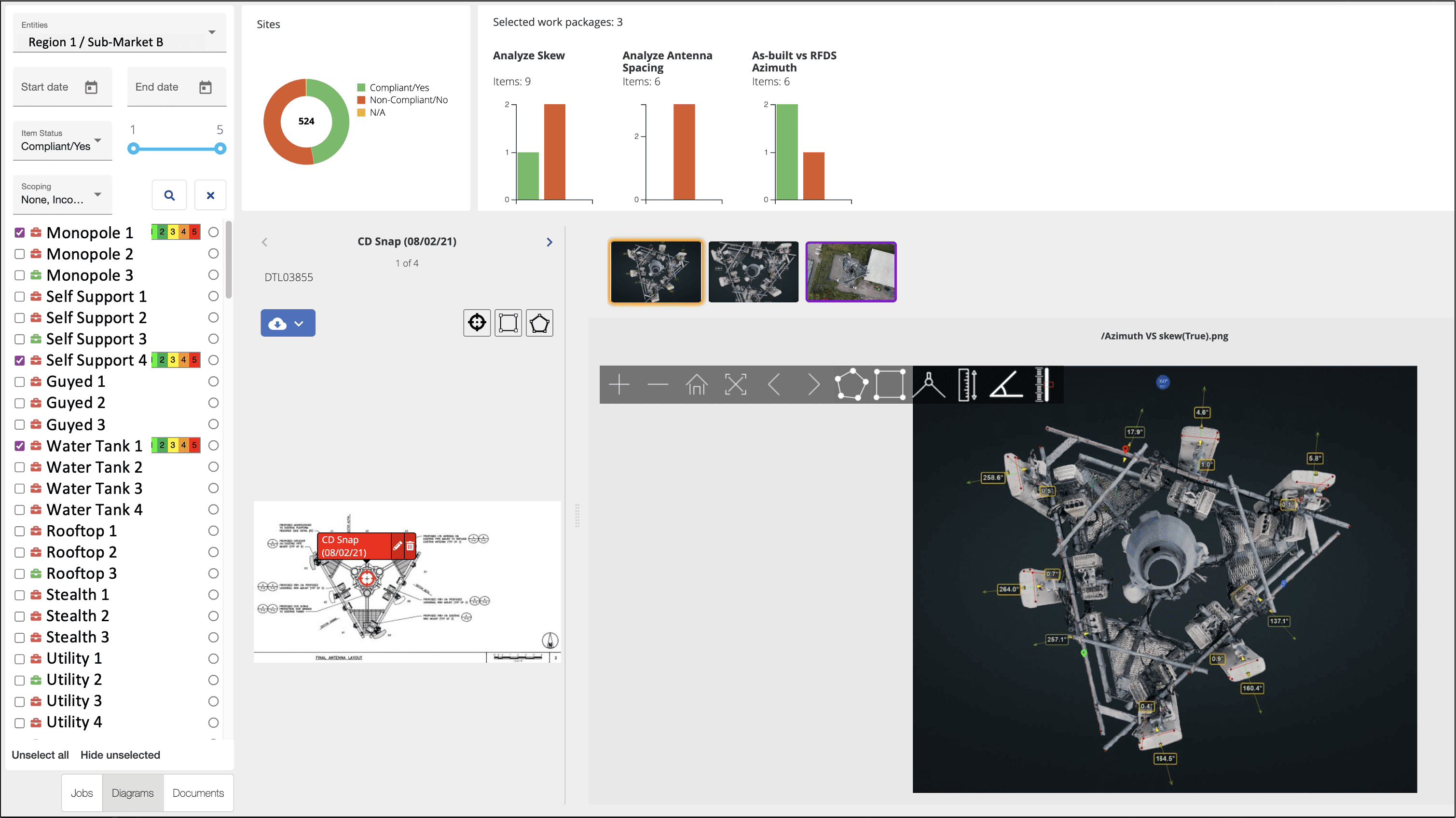
Analyze and geo-locate conditions
Our digital twin inspection software provides precise analytics tools to determine and geo-locate issues and conditions of assets, structures, building sites and equipment.
- Identify and geo-locate a variety of asset conditions up to millimeter level accuracy.
- Perform detailed measurements on assets for material, turnaround and repair planning.
- Measure distances, angles, estimate volumes, azimuths and heights of objects.
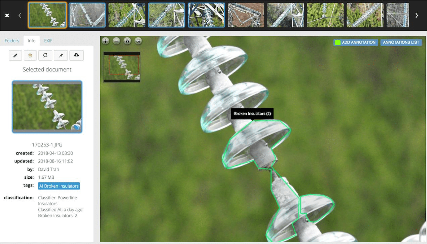
Computer Vision AI Inspection
Manage the entire machine learning and AI visual inspection workflow within the automated AI inspection software.
- Automatically identify issues down to the pixel level from inspection images automatically uploaded into the visual data management system.
- Utilize any vision AI inspection engine – no limitations – to complete automated AI inspections.
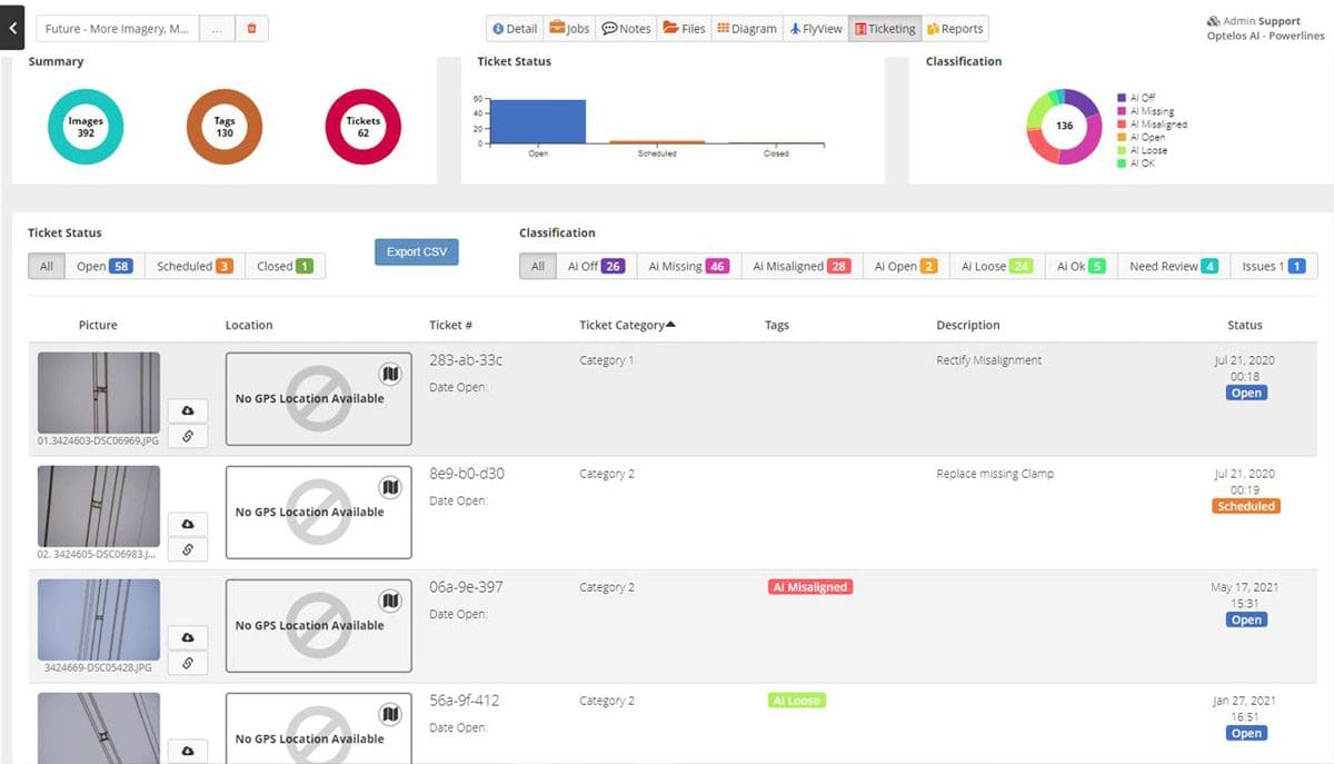
Ticketing and Dispatch Integration
Use built in ticketing dashboards or integrate with your existing ticketing and dispatch systems through the Optelos Open Data APIs.
- Seamlessly integrate with ticketing and dispatch systems to automate corrective actions.
- Optelos patented solution provides precise geolocation of all detected faults speeding issue resolution.
Track changes over time
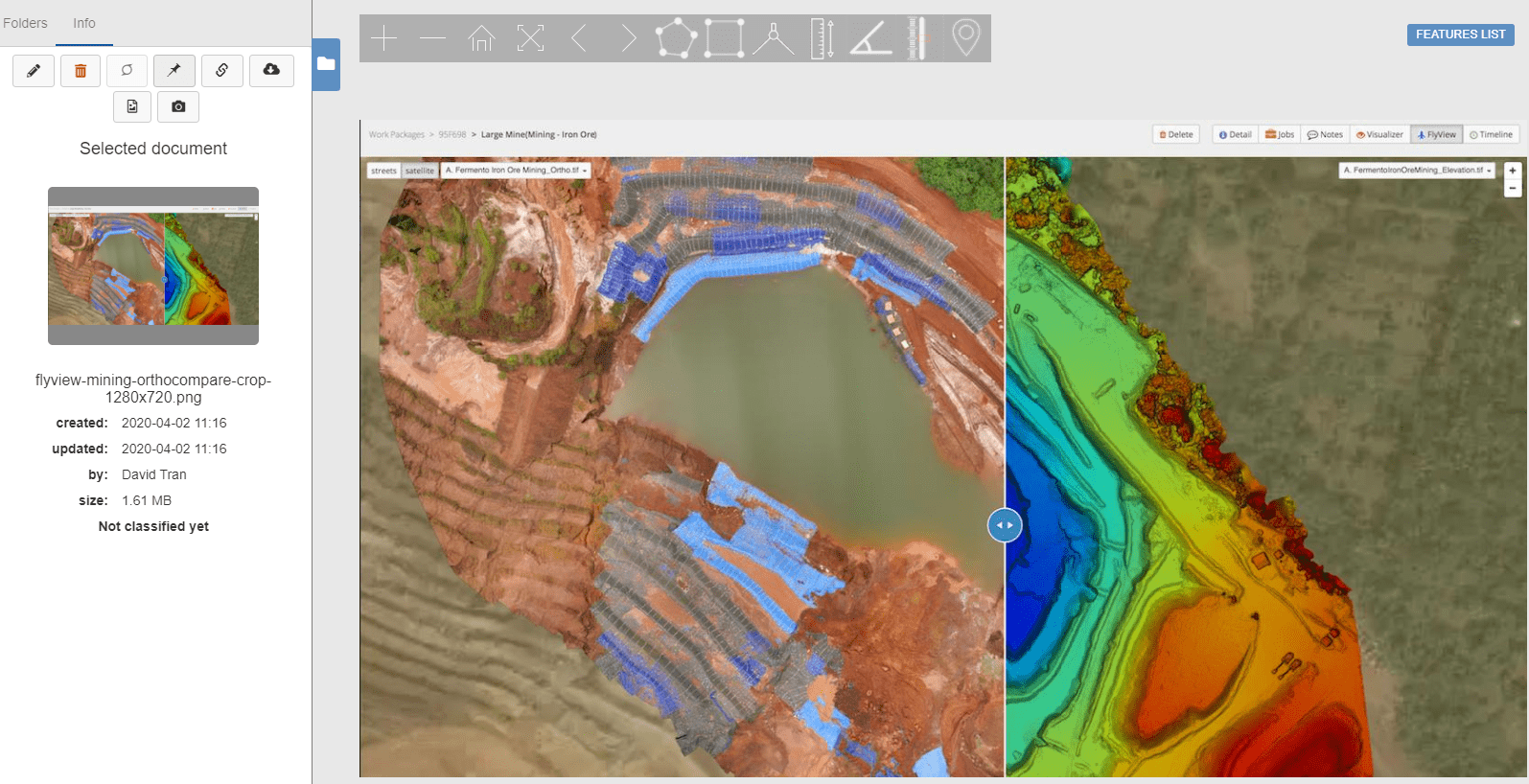
Visualize and compare orthomosaic maps and overlay detail maps.
- Powerful OrthoCompare™ feature allows you to compare drone mapping software orthomosaic maps to detect changes over time and perform audits.
- Overlay maps to quickly visualize site progress overtime using our Multi OrthoOverlay™ feature.
Manage Turnarounds and equipment safety
Optelos is an optimal digital transformation asset inspection tool for pre-planning and managing maintenance shutdown, turnaround and outage (STO) and TAR (turnaround) actions.
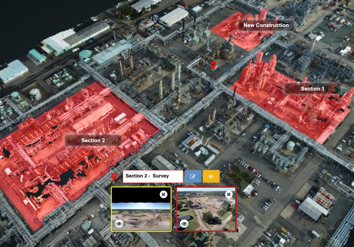
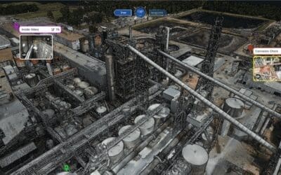
- Implement Digital Twin asset management with our 3D sectioning tool. Sub-select custom shape portions of Digital Twin models by removing visual obstructions from nearby objects.
- Digital Twin inspection software enables you to rotate, dissect and visually inspect, down to pixel-level, selected items.
- Isolate and share portions, sections or levels of 3D Digital Twin models, removing nearby objects or upper and lower levels, for a complete & unobstructed 360 degree view.
Report Generation Tool
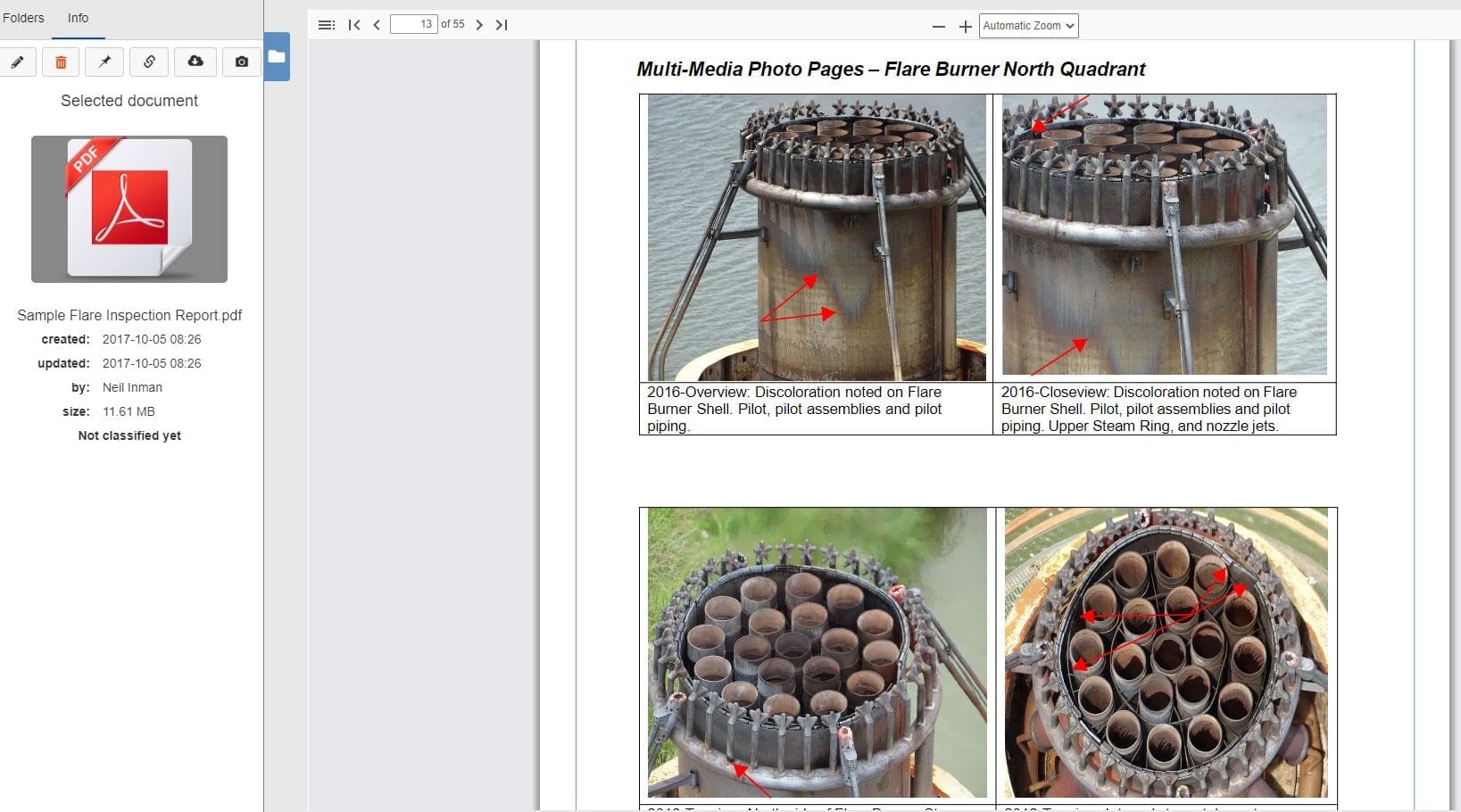
The Optelos visual data management system organizes your asset inspection information into an intuitive database, which allows you to create custom reports and status dashboards using your visual data.
- Create reports which track the status of defects by site, highlight entities which have completed their mandated inspection audits,
- Customized dashboards enable strategic monitoring of asset status by geography and can capture customized fields such as operational status, outstanding work orders, critical repair part requirements, and compliance flags.
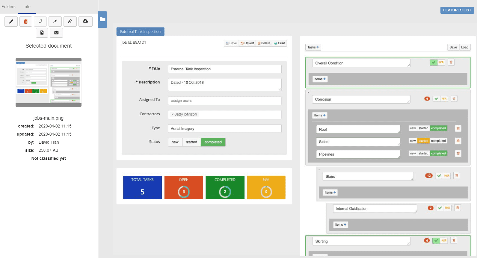
Customizable checklists and tasks
The Optelos platform can be utilized to operationalize your digital transformation asset inspection program by creating routine jobs and tasks integrated into your teams’ workflow.
- Utilize the menu options to select from a customizable list of possible outcomes and assign to groups, outside vendors or individuals.
- Maintain oversight of each identified defect or deficiency and utilize reports and dashboards to summarize overall team, site or vendor performance.
- Monitor tasks assigned, completed, and task aging reports by team, site and reporting region.
Further Reading on the Optelos Platform
Leveraging New UAV Utility Inspections Technology to Improve Wildfire Mitigation Plans
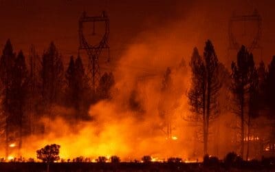
Power utilities are already leveraging UAV utility inspections paired with effective data management to improve their infrastructure inspection programs. They’re deploying sensor technologies such as LiDAR and drone RGB image capture to accurately identify risks, including encroachment clearance and vegetation health, and inspect infrastructure conditions.
Drone Data Management Increasingly Critical for Achieving Digital Transformation in Asset Inspection
Drone data management continues to be a critical factor as drone-based asset inspections have been growing rapidly over the last several years, and the growth is expected to continue well into the future. Research by ReportLinker.com indicates that the drone software...
Scaling an Enterprise Drone Inspection Program
Scaling an Enterprise Drone Inspection Program The benefits of drone inspection programs are well established in several industries, especially those with complex or distributed assets that require regular inspection, maintenance, or compliance verification. These...
