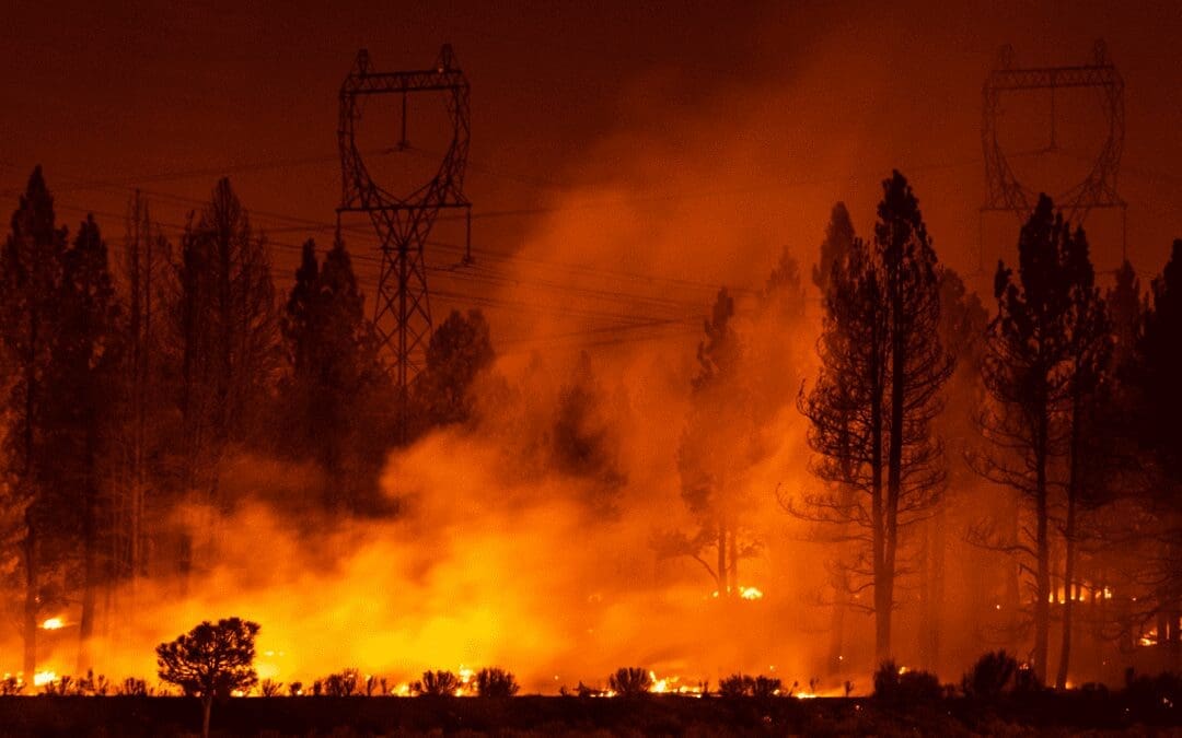
Utilities are using drone power line inspections to plan for and combat the risk factors leading to wildfires, which are only projected to get worse over the coming decades. According to a February 2022 report from the UN Environment Programme (UNEP) and GRID-Arendal, “climate change and land use changes are projected to make wildfires more frequent and intense, with a global increase of extreme fires of up to +14% by 2030, +30% by the end of 2050 and +50% by the end of the century.” Certain regions will be more susceptible to these increases, including wildfire-prone regions in the western United States, where many state regulatory agencies are already mandating wildfire mitigation planning in order to better protect local communities and lessen the risk of devastating wildfires.
While the headlines often cover the large IOUs that operate some of America’s largest power grids, there are also many small rural electric cooperatives (RECs) managing wildfire risks. There are approximately 900 RECs that are the primary energy providers to most of the country’s rural areas — serving 12% of the nation’s electric consumers, but owning and maintaining 42% of the nation’s electric distribution lines that cover 56% of the country’s land mass. All utilities, both large and small, are required to plan, maintain and operate their electrical grids in a manner that minimizes the potential for wildfires.

Figure 1: In the western US, overhead high voltage power lines often traverse rugged mountain terrain that’s difficult to access and at high risk to wildfire and adverse weather impacts
Utilities are taking aggressive action in response to the increasing risk of wildfires. In California, for example, Investor-owned utilities (IOUs) operating in the state are required to prepare and submit annual Wildfire Mitigation Plans (WMPs) to state regulatory agencies for review and approval. These WMPs describe in detail how the electric utility is constructing, maintaining, and operating its electrical lines and equipment in a manner that will minimize the risk of catastrophic wildfires. In addition to mandated 100% annual inspection of Tier 3 transmission lines in High Fire Threat Districts (HFTDs) and every three years in Tier 2 High Fire Threat Areas (HFRAs), power utilities are also deploying Enhanced Vegetation Management (EVM) protocols, system hardening (such as covered conductor deployments or undergrounding of overhead circuits in HFTD areas), and new technologies to monitor current status and environmental conditions predicted to impact their infrastructure. These technologies include high-definition cameras for actively monitoring HFTDs, weather stations to monitor for grid point environmental conditions conducive to wildfires (temperature, relative humidity, wind, and estimated vegetation/fuel moisture levels), and use of drones for enhanced asset inspections.
Utilities are already leveraging drone-based inspections paired with effective data management to improve their infrastructure inspection programs. They’re leveraging sensor technologies such as LiDAR and drone RGB image capture in UAV utility inspections to accurately identify risks, including encroachment clearance and vegetation health, and inspect infrastructure conditions. According to their 2021 WMP, one large California IOU moved from a practice of completing inspections on a time-driven cadence by plat map to enhanced asset inspections utilizing drones and digital technology to address the increased risk from overhead asset or component failure in HFTD and HFRA areas. Utilizing enhanced asset digital inspection techniques, the scope of inspections was expanded to identify potential equipment issues that could result in wildfire ignition.

Figure 2: UAV utility inspections of overhead transmission assets are becoming more common as drone flight duration has increased to over an hour and FAA regulations have become clearer.
Enhanced detailed inspection of overhead transmission assets seeks to proactively identify and treat pending failures of asset components which could create a fire ignition if left unresolved or allowed to “run to failure.” Proactive identification of Level 2 and Level 3 concerns are then prioritized by risk and consequence in regard to distribution and transmission tower maintenance. Enhanced inspections for transmission assets typically involve at least two detailed inspection methods per structure: ground and aerial. In addition to the ground and aerial inspections, climbing inspections are also required for 500 kilovolt (kV) structures or as triggered. All these inspection methods involve detailed, visual examinations of the assets with use of inspection checklists that are in accordance with the Electric Transmission Preventive Maintenance (ETPM) (TD-1001M) as well as the FMEA. Aerial inspections may be completed either by drone, helicopter, or aerial lift.
This leverage of UAV utility inspections led to improvements in the corrective notification creation rate for distribution facilities, rising from 11% to of 23% of inspected assets. This more than doubling of discovered faults is in a large part due to the efficiencies offered by drone-based inspections and enhanced digital inspection data management capabilities, which enables greater organizational leverage by distributed maintenance teams due to its accessibility and accuracy.

Figure 3: LiDAR sensors can be used to create highly accurate 3D models of overhead transmission assets and substations, enabling repair teams to view infrastructure configurations prior to heading out to impacted sites.
The other advantage to utilizing digital UAV utility inspections with effective data management is that it enables maintenance teams responding to outages to review imagery and 3D models of affected areas before heading out to better understand the equipment and terrain situation they’ll be encountering. This allows them to load up the bucket truck with everything needed to make repairs at the impacted site, improving safety and speeding up outage restorations. “In Colorado, one of the big things is wildfire mitigation and responding to major weather events.” says Bill Hanovec, GIS Lead at Sangre de Cristo Electric Association. “You may have an opportunity to get things turned on quicker when you’re rebuilding if you can get an eyeball on it (digitally), so you can see what options are available to you.”
“You may have an opportunity to get things turned on quicker when you’re rebuilding if you can get an eyeball on it (digitally), so you can see what options are available to you.”
One California utility has been annually collecting more than two million high-resolution images of their electric transmission assets using drones, helicopters, and other means since 2019. This massive database of imagery is used to conduct annual infrastructure inspections and monitor asset health, but keeping track of millions of inspection images using conventional data storage methods is not practical. Due to the unstructured nature of image files, accurately determining which images belong to which assets can be a challenge when dealing with just a few thousand images, as many of the images look alike due to the nature of standardized infrastructure assets. When dealing with millions of images, however, managing and operationalizing the data is virtually impossible without the right technology.
Large, well-funded enterprises can develop their own in-house data management systems, but it is a daunting and never-ending endeavor. One large IOU disclosed their ongoing platform development efforts, which took two years, over $10M in direct investment and involvement from more than 200 personnel to develop an in-house data management and analytics system capable of managing, processing & analyzing visual data from their asset inspection program. The ongoing IT support and infrastructure management of this initiative is also significant, estimated to top seven-figures annually. By their assessment, the commercially available Optelos platform offers equivalent performance to their in-house solution, is available at a fraction of the price and includes ongoing software support, forward-looking platform enhancements, open-API systems integration apps and unlimited, secure cloud-based storage.

Figure 4: Optelos allows electric utilities to view and access inspection imagery in geospatial context, automatically associating images with the correct asset utilizing GPS and timestamp metadata.
Optelos’ robust data management capabilities and expansive features, including end-to-end AI workflow management, allow it to act as the cornerstone of an electric utility’s visual inspection data management program. As a SaaS application, Optelos allows geographically distributed users to simultaneously access detailed inspection models and imagery in geographic context along with associated data (such as spec sheets, inspection reports, 3D walk-through captures, operational metrics, panoramas, etc.) and enables workflow customization to route data and file access individually, by role or by team association. Inspectors and project managers can also make annotations and corrections directly on the images, creating a single point of truth for determining true asset status, capturing detailed instructions or inspection notes to address identified repair issues.

Figure 5: Power utilities can track all issues associated with individual tower assets by geography in roll-up dashboards, enabling HFTD and HFRA tracking and prioritization for effective resource allocation and reporting.
For utilities looking to the future with an intention to deploy computer vision AI and machine learning, the Optelos platform can also manage the entire end-to-end AI development, deployment and training workflow. Utilities can deploy this option when ready, as the standard Optelos Enterprise Asset Advisor system comes fully capable of AI management. Utilities can utilize integrated capabilities within the platform to annotate and label image files for creating, deploying and improving AI classifier models. The resulting computer vision AI models can be trained to classify photos to identify asset components, then search for potential issues within a class in an automated, predictable and controlled fashion. AI models can be used to flag select images (e.g., broken insulator, damaged vibration damper) for inspectors. Inspectors can review the label data and provide feedback on the predictions within the platform, which improves the models over time, reducing the inspection time while improving inspection quality and trust in the AI brain. Another application for artificial intelligence is in identifying dead and diseased trees – large pockets of which can cause fires to start more easily, spread more rapidly, or even initiate fires when trees and limbs fall on power lines. The Accenture Federal Services Discovery Lab recently collaborated with the US Department of Agriculture to develop a computer vision model to identify dead and diseased trees in real-time using NASA’s Landsat, which can enable greater, more accurate visibility of areas impacted by severe tree mortality, increase oversight or fuel mitigation of those HFTDs and therefore reduce the risk of severe wildfires.

Figure 6: Computer vision AI can be used to identify areas impacted by severe tree mortality to increase oversight or schedule fuel mitigation to reduce the wildfire risks.
Electric power companies seeking advice on how to incorporate UAV utility inspections for infrastructure monitoring and maintenance, wildfire mitigation planning, disaster response or facilities management can receive a free program assessment from an Optelos Solutions Expert. Along with our technology partners offering leading edge capabilities in autonomous drone operations, computer vision AI, cloud computing & storage and enterprise systems integrations, we can develop a cost-effective program to meet your immediate operational needs with a robust and technologically capable platform that can grow with your evolving adoption of new digital technologies. Contact us today at hello@optelos.com, or click on the Get Started link below.