Optelos Q4 2020 Software Release
As part of Optelos’ continued commitment to providing the industry’s leading Visual Data Management and AI platform to our customers, Optelos is excited to deliver our latest software release. Our Q4 2020 release includes features to allow customers to create interactive diagram models of their worksite and assets, add geo-located folders, add external links, and much more.
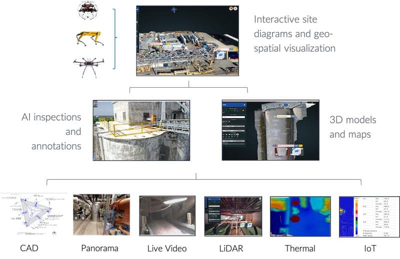
These innovative features allow asset owners and stakeholders to quickly visualize critical asset data faster than ever before.; taking their digital transformational experience from one of raw data to refined analysis at a single click. This allows users to gain immediate enhanced insights:
- Interact with site diagrams, 3D models, and maps to see critical information
- Drill down to relevant details including documents, drawings, and other data
- Associate additional data for dispatch and reports


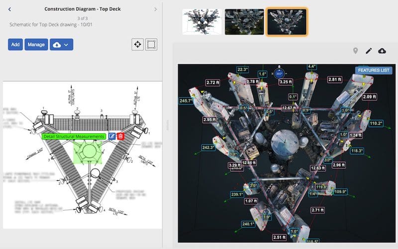
Diagram Tool
Interactive inspection diagrams to quickly share and collaborate

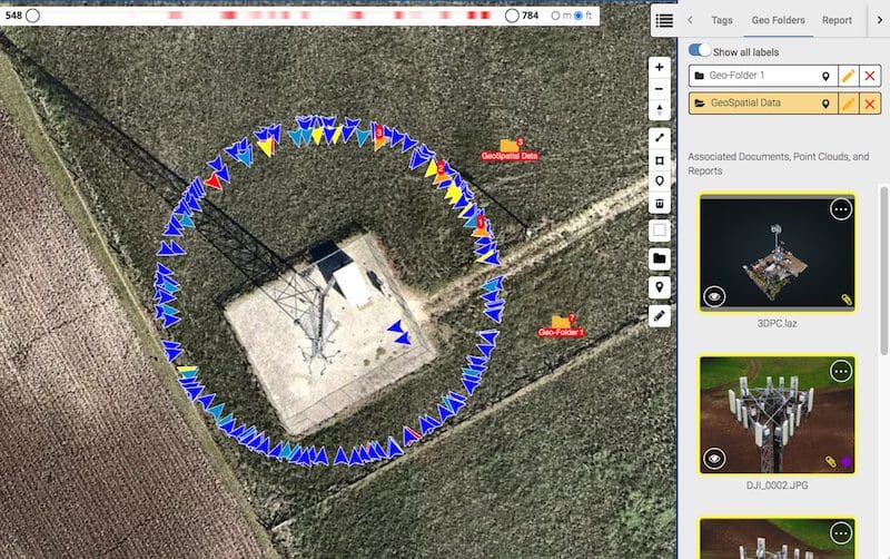
Geo Folders
Add geo-located folders to organize data

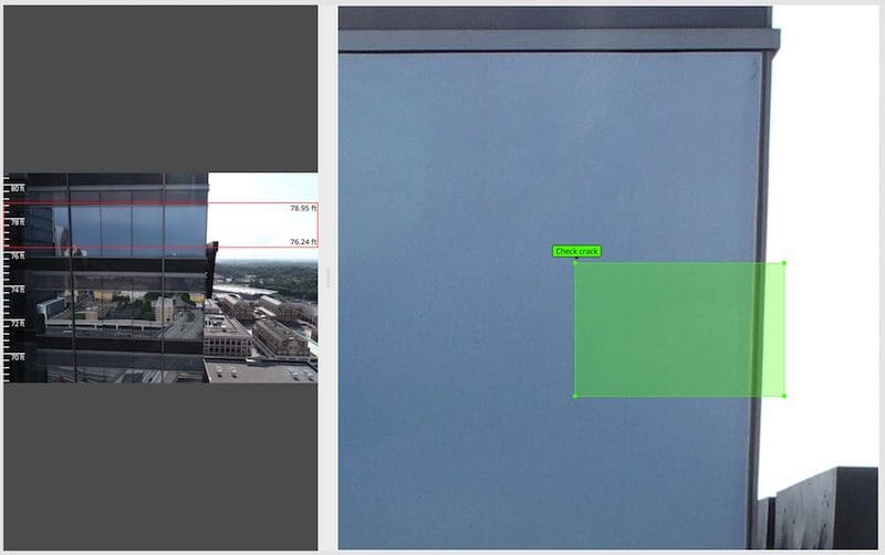
Facade Viewer
Quickly add scale ruler to inspect buildings and other facades
These features are immediately available to our Optelos Enterprise Asset Advisor customers on the Visual Inspection and Enterprise Asset Advisor software suite.
Contact us to learn more about the Optelos platform and these amazing new features.
Summary of Q4 2020 Feature Releases
- Diagram Hotspot Tool. Powerful tool for creating interactive diagrams with hotspot labels to convey important information to stakeholders, enabling a dynamic report of detailed Points of Interest.
- Quickly add geo-located folders on FlyView™ maps to associate any document data type, (even those without any GPS data) to any asset type. This provides fully immersive geo-spatial context to your data; from a ‘site overview’ perspective zoomed into specific asset/location analytics across all data types.
- Add External Links. Elegantly simple feature to allow the creation of external visualization links to third party software that support embedded links such as MatterPort, Navvis, AutoCAD 360 Viewer, and many more.
- Facade Measurement Tool. Add a measurement ruler display to any image & ortho image. This allows inspectors to quickly understand reference information such as scale and height of the structure for easier defect detection.
- Composable Report Sections. Users can now build semi customizable reports by selecting different content sections to include in the report in line with your workflow or deliverables.
- Other Features. We have also made a few other enhancements to existing features.
- Angle Measurement Tool. Quickly measure angles on 2D images
- AutoCAD file viewer. View AutoCAD .DWG and .DXF file formats
- ServiceNow. Integration to ServiceNow trouble Ticketing (optional)
- Infinity Scroll. Seamlessly scroll through all your documents without the need for pagination.
- KML KMZ support. Upload and view KML /KMZ files that contain routing and other site details.
Optelos is expert at helping enterprise customer select the solution that’s right for them today and can scale to support their future needs as well. If your starting or growing a drone or visual inspection program, please contact us and find out how we can help you avoid the many pitfalls that lie ahead.
Contact us at info@optelos.com and let us help you start your digital transformation journey and see how you can realize significant cost savings in your asset management programs.