Drone Service Providers
Scalable drone data management for inspections and photogrammetry
Store, manage and share commercial drone inspection data for all your customers in one secure platform
Share commercial drone inspection results, 3D Digital Twin models and standardized reports with customers using our data viewers and visualization tools, improving customer experience, account retention and revenue growth
Provide your customers with a world-class experience for viewing drone inspections on a single drone inspection data management platform with integrated data viewers, intuitive UI and predictable and systematic data organization
Download white paper
“8 Ways to Optimize Drone Asset Inspections: Optelos Puts Together Lessons Learned from Enterprise Clients”
Robust Data Management for All Your Projects
Manage all your commercial drone inspection data across all projects, keeping data separate and securely accessible by customer.
Superior Customer Experience
Drone data management solution with integrated viewers enables viewing large 2D ortho, 3D Digital Twin models and CAD files without underlying software licenses.

Improved Client Collaboration
Integrated visualization, analysis and measurement tools allow customers to use data from drone inspections and share models for planning, RFQs and asset management.
Optelos DSP Inspector™ SaaS platform provides a complete drone inspection data management solution to deliver best in class imagery, videos, 2D and 3D models to your clients
Organize and Share Vast Amounts of Geospatial Data from Drone Inspections
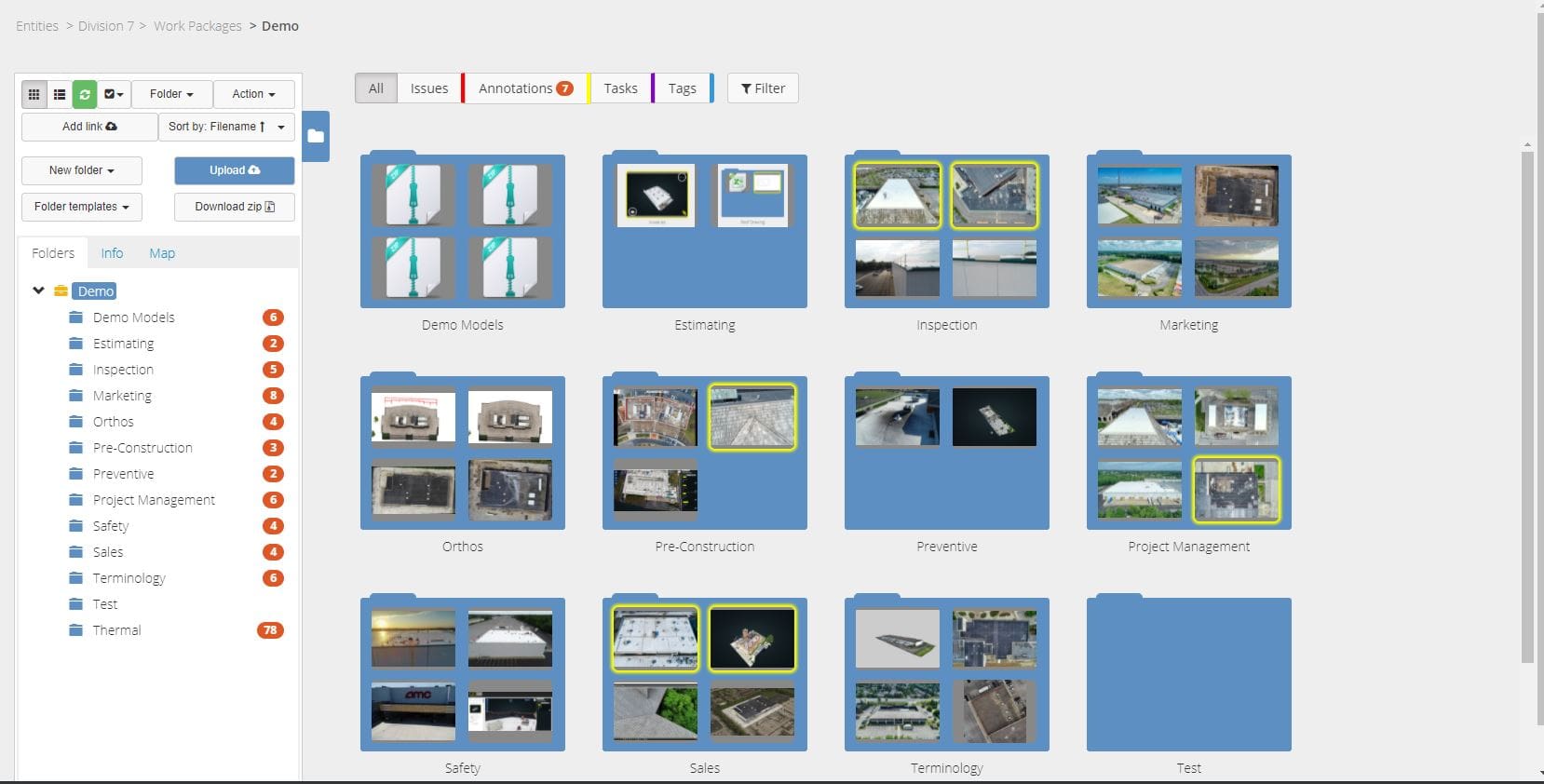
Optelos systematically aggregates and organizes unstructured imagery from drone inspections into an organized and searchable database ready for customer access.
- Upload and manage commercial drone inspection data in a single unified database, eliminating parallel workflows, lost files and data silos.
- Integrated data viewers allow customers to open and view 360, 2D orthomosaics and 3D Digital Twin models without licenses to underlying software.
Complete Precise Measurements and Analysis of 3D Digital Twin Models
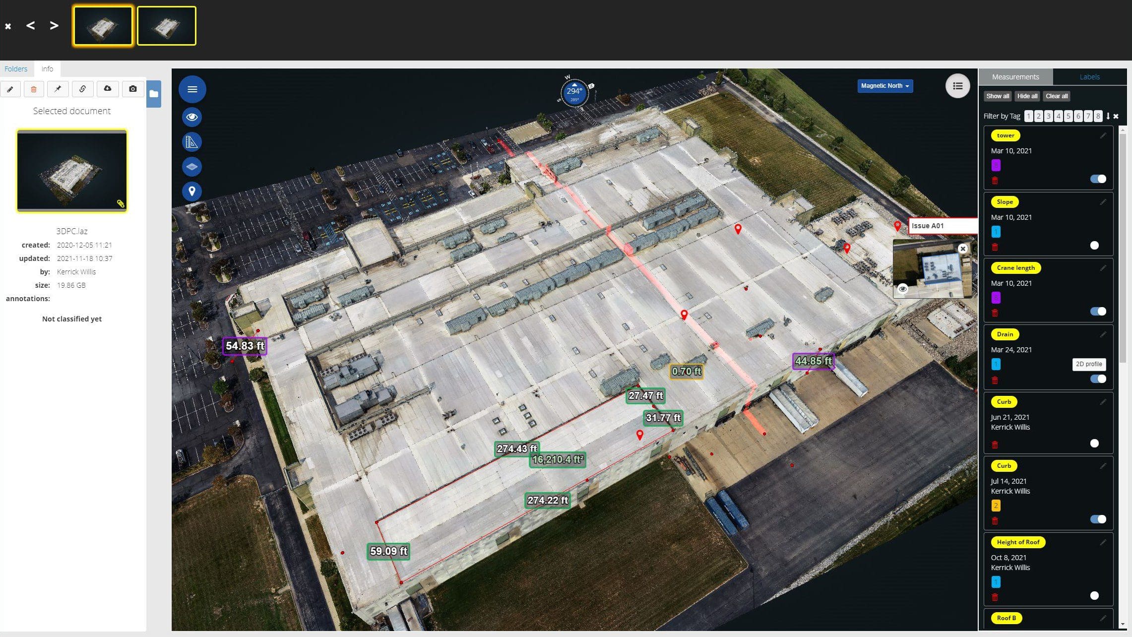
Make precise measurements and complete detailed analysis without a site visit. Utilizing 3D Digital Twin models made from your drone inspections, you and your customers can complete pre-project scoping and analysis.
- Integrated measurement tools allow measurements with 1mm accuracy and .1 degree angle.
- Measure lengths, heights and angles. Annotate models with measurements or discovered issues to clarify inspection findings or support recommended actions.
See All Relevant Data in Geospatial Context
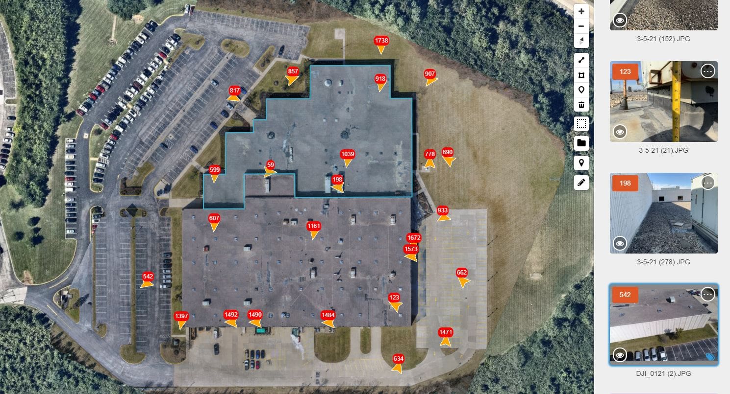
The platform’s patented algorithms utilize geolocation and timestamp metadata to organize and correlate relevant asset images from drone inspections, in any format (photo, video, 3D model, sensor, LiDAR, thermal), for a complete view of assets.
- Manually append other relevant documents, such as building codes, inspection reports, engineering plans & work orders onto 2D maps and 3D Digital Twin models.
- Find desired images using map view, which places a directional icon onto the satellite map to show where each commercial drone inspection image was taken and the camera direction.
Professional Reports and Dashboards Improve Customer Communications
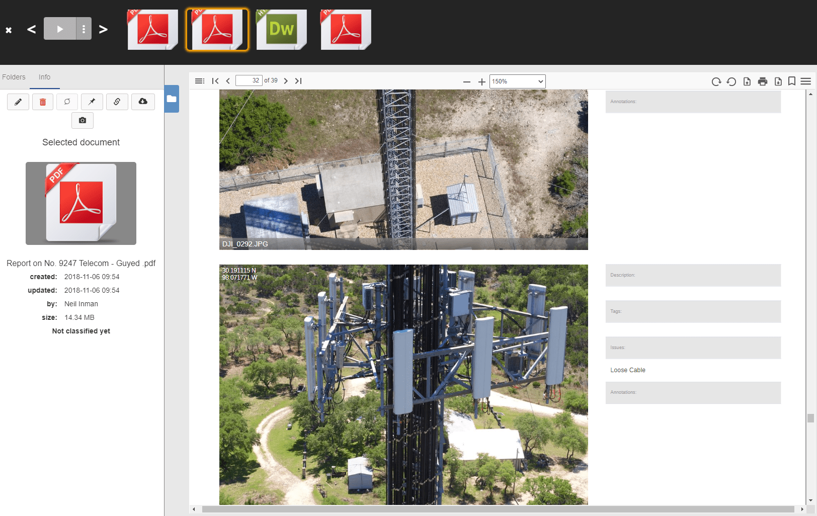
Create professional, customized reports of drone inspections by site, including detailed images of detected faults, notes and GPS coordinates of each image.
- Report template tool makes creating reports fast and easy when using a drone for inspection.
- Customize reports with your company logo and contact information for a more professional presentation of your commercial drone inspection results.
- Upload reports onto the platform from the field to speed customer communications and improve service levels.
Include Ground Level Site Inspections in Your Service Offering
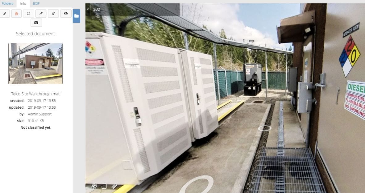
In addition to drone data management, Optelos seamlessly integrates Matterport 3D walkthrough visualizations, allowing customers to view ground-level 360 site imagery for a complete view of inspected assets.
- Utilize 360 walkthroughs to capture the inside of cell tower huts, manufacturing facilities, tanks and other situations where traditional drone inspections are not feasible.
- Offer complete services to real estate agents, property managers and others who rely on 3D walkthrough imagery for their core business.
