Systems Integrations
AI-Powered Geospatial Data Management Platform
Open data APIs and AI ML ensure geospatial inspection data is shareable and accessible across the enterprise
A key design philosophy of the Optelos geospatial data management platform is to enable visual inspection data sharing across enterprise systems to improve organizational data leverage
System Integrations
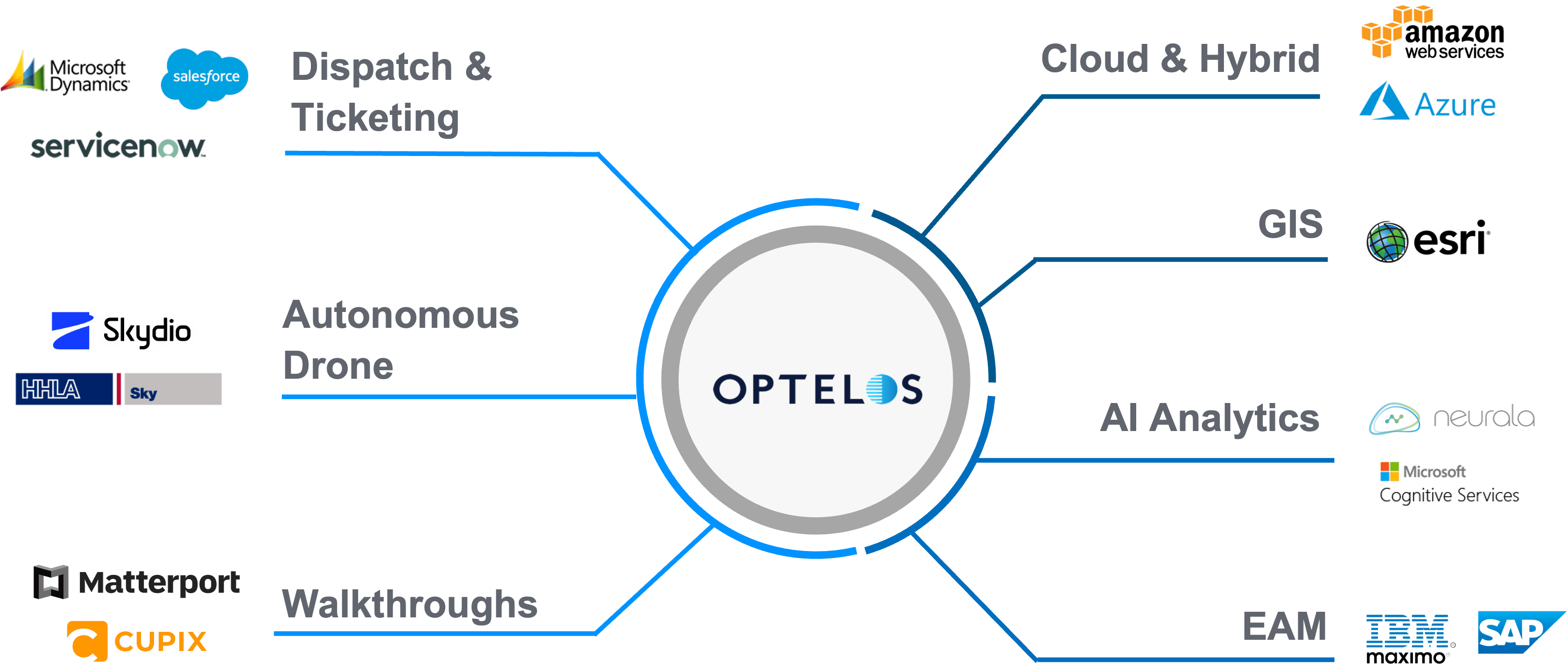
Digital transformation of asset inspections involves optimizing software application processes utilizing visual inspection data and making workflows faster, easier, and more efficient. Optelos’ open data APIs enable bidirectional interfaces with other Enterprise systems such as SAP, IBM Maximo and ServiceNow trouble ticketing, manufacturing BOMs, and many more. Optelos’ APIs provide access to AI ML analyzed data and 3D digital twin model information to a wide variety of BI systems, enhancing enterprise decision support and improving organizational efficiency through automated workflows and actions.
Autonomous Robotics and Drones
Geospatial data from drone inspections (images and sensor data) can be automatically uploaded into the Optelos platform from Skydio autonomous drones for systematic computer vision AI processing, evaluation and prioritization.
- Optelos patented technology extracts geolocation, telemetry and time stamp metadata to improve image file organization and presentation.
- Autonomous robotic and drone inspection data is managed in a single process flow, available for AI analysis and secondary workflow review and collaboration.
AI and Machine Learning Analytics
The Optelos platform includes complete computer vision AI functionality for managing the entire AI ML data transformation process within the platform. Drone inspection images can be automatically uploaded via Wi-Fi into the Optelos system for AI and machine learning processing, classification, prioritization and action.
- Triple the efficiency of your visual inspection team by allowing them to focus on the images flagged by the AI for further evaluation.
- Improve the accuracy of your artificial intelligence brain by using intuitive tools within the Optelos platform to add or improve classifiers, eliminating duplicate data silos and saving time and money.
Dispatch/Ticketing
Connect the Optelos geospatial data management platform via APIs to ticketing and dispatch systems and business processes such as ServiceNow, Microsoft Dynamics and Salesforce to automatically create trouble tickets and direct repair action to the precise location of detected issues from visual inspection data.
- Each image is geolocated and time stamped using Optelos’ patented technology.
- Manage repair classification and prioritization within the platform.
Virtual Walkthroughs
Upgrade your visual inspection data management by integrating Matterport 3D walkthrough or any 360 camera panorama images into Optelos for a complete view of the site, infrastructure and equipment under inspection.
- Gather imagery for areas difficult to capture with flying drones, such as under roofs, inside buildings, tanks, control sheds or other space restricted areas.
- Integrate structural assessments, ground equipment and interior building inspections into project reports.
Enterprise Asset Management
Link with EAM systems to utilize geospatial inspection data and digital twin 3D models more broadly across the organization:
- Integrate with all leading EAM systems
- Feed visual asset inspection data into predictive maintenance models, tracking and forecasting corrosion progression.
Cloud Deployment
Access to the Optelos visual data management database can be deployed behind the firewall, on the cloud or in a hybrid format depending on each user’s security policies:
- Full cloud deployment with enterprise-grade security offering from cloud providers.
- Hybrid deployment model with software served over the cloud accessing databases behind the firewall.
