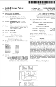
Optelos patent of geospatial data transforms visual asset inspection results into actionable insights
Optelos Patent: Supporting Rapid Growth of Visual Inspection Data
Enterprises across all industries are under increasing pressure to proactively monitor and manage physical assets, driving the need for more frequent visual inspection. As a result, Enterprises are utilizing visual data captured from Drones, Robotics, and Industrial IoT sensors as a critical part of a visual asset inspection and geospatial data management program.
Tremendous business intelligence exists in the ability to extract, correlate and analyze the inspection metadata (such as precise GPS coordinates, time stamp and telemetry data) alongside the visual imagery, videos, reality models, and sensor readings. This intelligence reveals the ground-level truth of critical assets across the entire Enterprise. It provides the ability for the dynamic data visualization and AI analytics that can provide the following insights:
- When are critical events occurring, and how can I reduce my time to remediation?
- How are my assets changing over time?
- What’s the status of my infrastructure, and what further inspection and maintenance actions are required?
Optelos Patent: Geo-referenced Visual Data Correlation and Transformation
One foundational requirement of visual inspection data management and analytics is the ingestion, correlation, and transformation of all this unstructured visual data into a digital visual inspection management database. Visual inspection data is notoriously difficult to manage because of its unstructured format, as you have to actually look at the image to know what you have.
Optelos is the only visual data management system that has been granted a patent (US Patent No: 10,418,068) for the correlation and transformation of geo-referenced visual data into a digital asset inspection database. Our patented software technology includes:
- Visual Data Transformation. Aggregate, process and transform raw visual data such as images and videos together with geo-referenced telemetry and other data elements into an indexed and standardized digital format.
- Indexed Visual Database. Integrate visual data into a highly structured database array that links the data through correlated digital fingerprints such as positional telemetry data, time stamps, metadata, and other related digital markers. This enables high speed search and data analysis operations without the need to manipulate the raw data, which significantly reduces costs, eliminates data silos, and improves performance at scale.

Optelos patent for Visual Data Recording Synchronization System
Optelos is excited to have deployed our patented solution to help Enterprises such as Georgia-Pacific, Latin American utility company SAESA, as well as our partners Microsoft and Accenture to as they automate and operationalize the visual inspection process for detecting asset conditions, identify issues and remediate those issues for leading Enterprise clients globally.
Enterprises are able to act on the digitalized data through AI-powered analytics and automatically correlate this data to bring the field insights back into the office to empower stakeholders to make better decisions, increase efficiency and raise operational agility.
Contact us at info@optelos.com and let us help with your visual data management and asset inspection program.